


Setting the Stage
Wide Sweep
Feeding the Beach
Fellini's Playground
Fellini Is Taking Notes
Missing
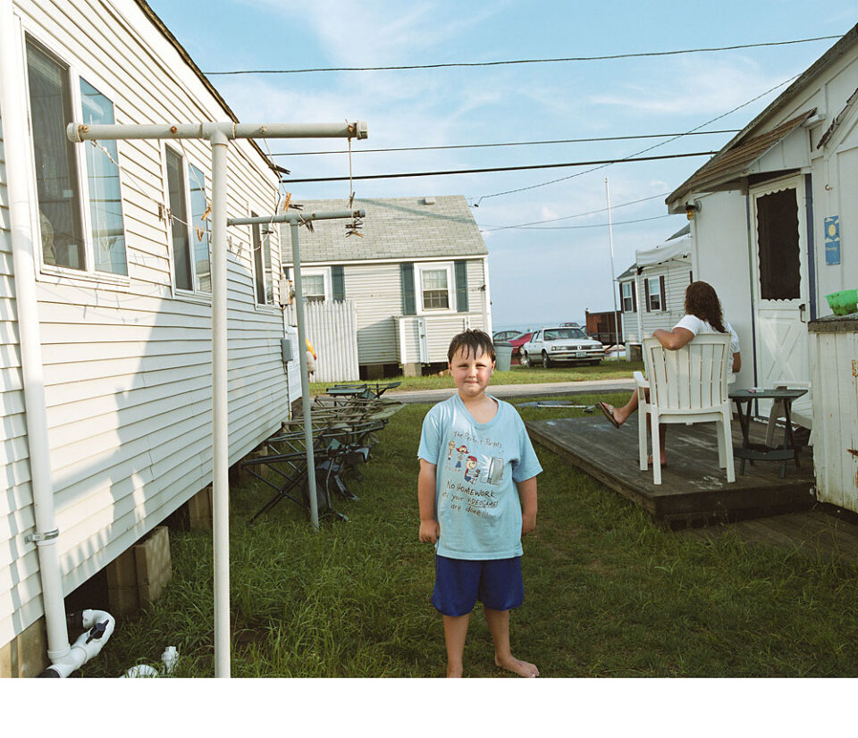
Easy Living
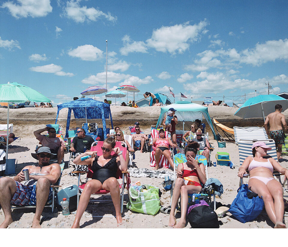
Fun in the Sun
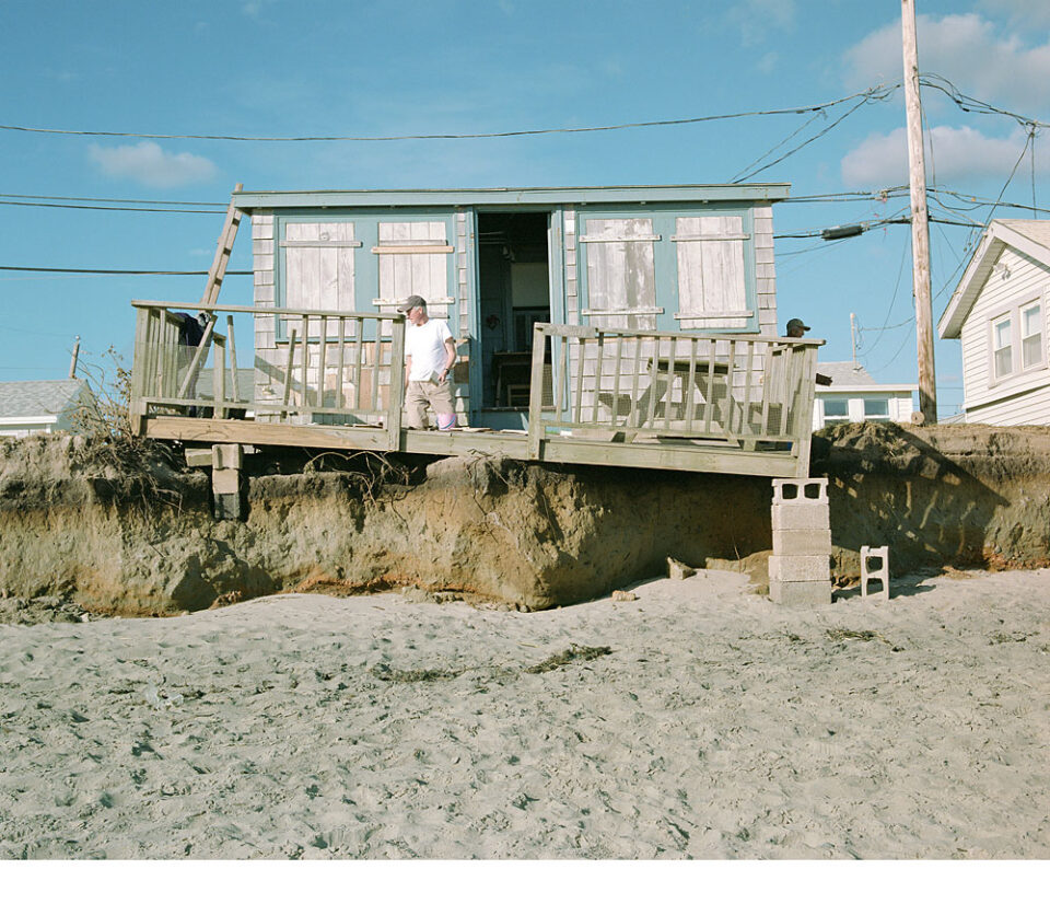
Teetering
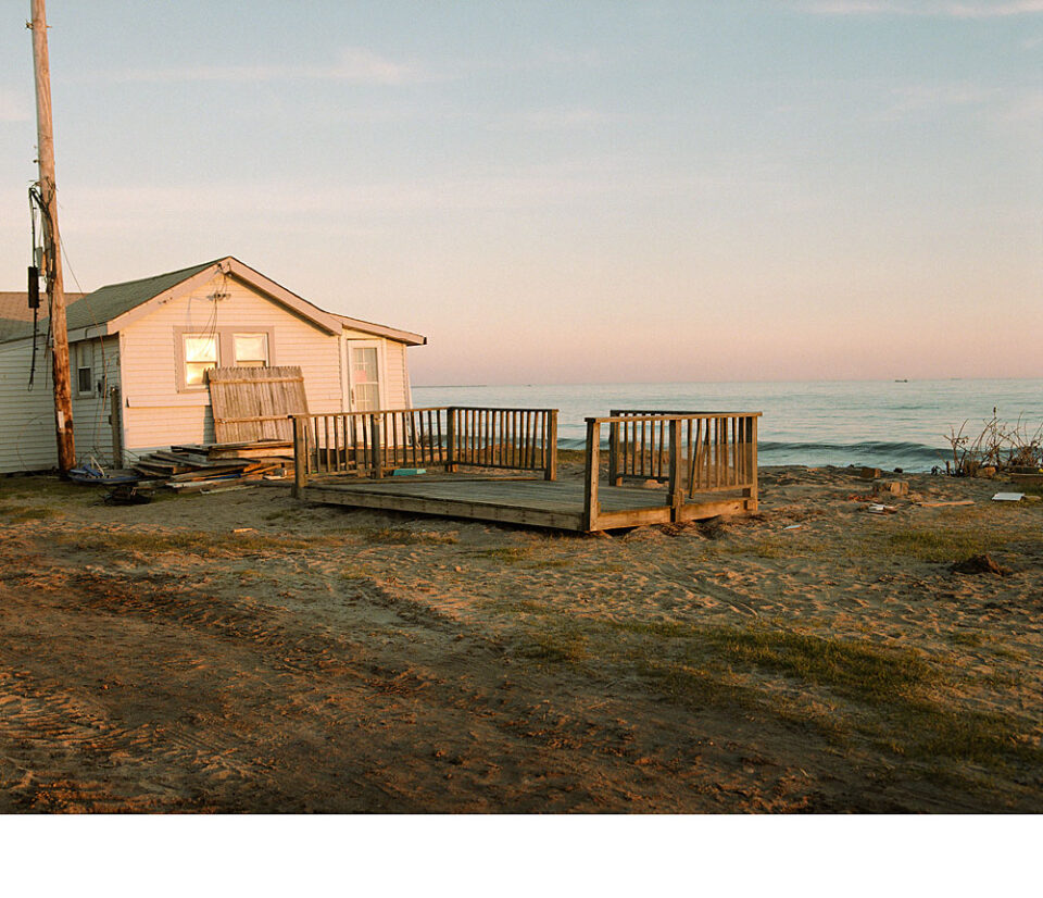
Echoes of Sandy
Haunted
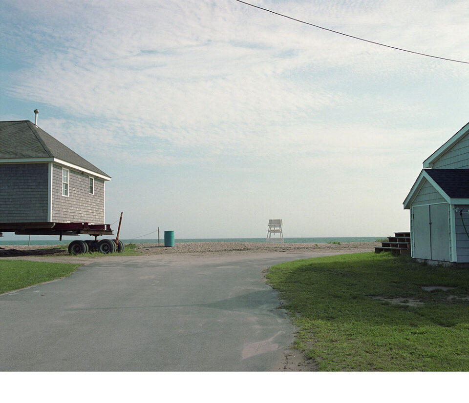
Moving House
Coming Undone
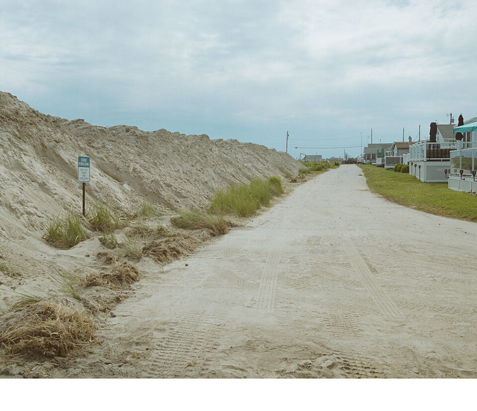
Miles of Piles
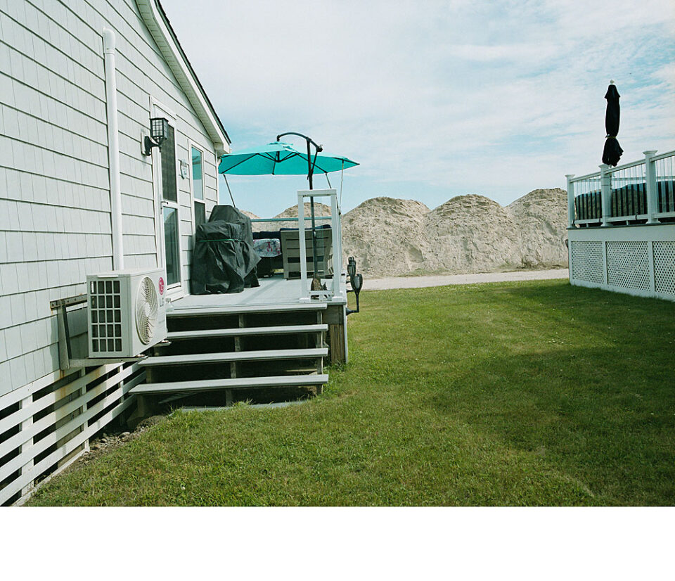
A Room with No View
Dune-building
Welcome to the Neighborhood
A Tale of Two Beaches
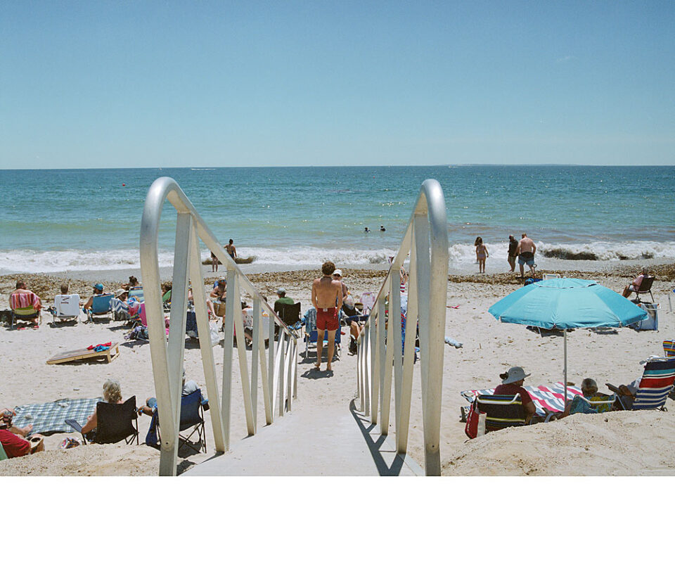
Ramping Up
The Best of Both Worlds
Kitsch
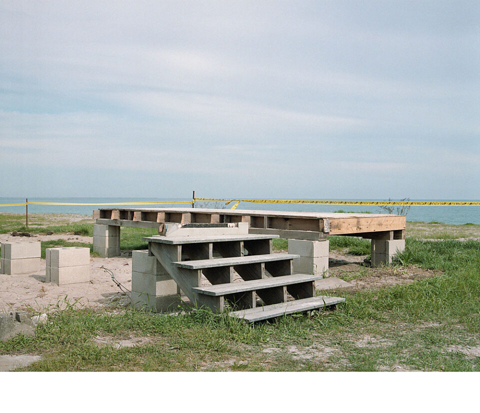
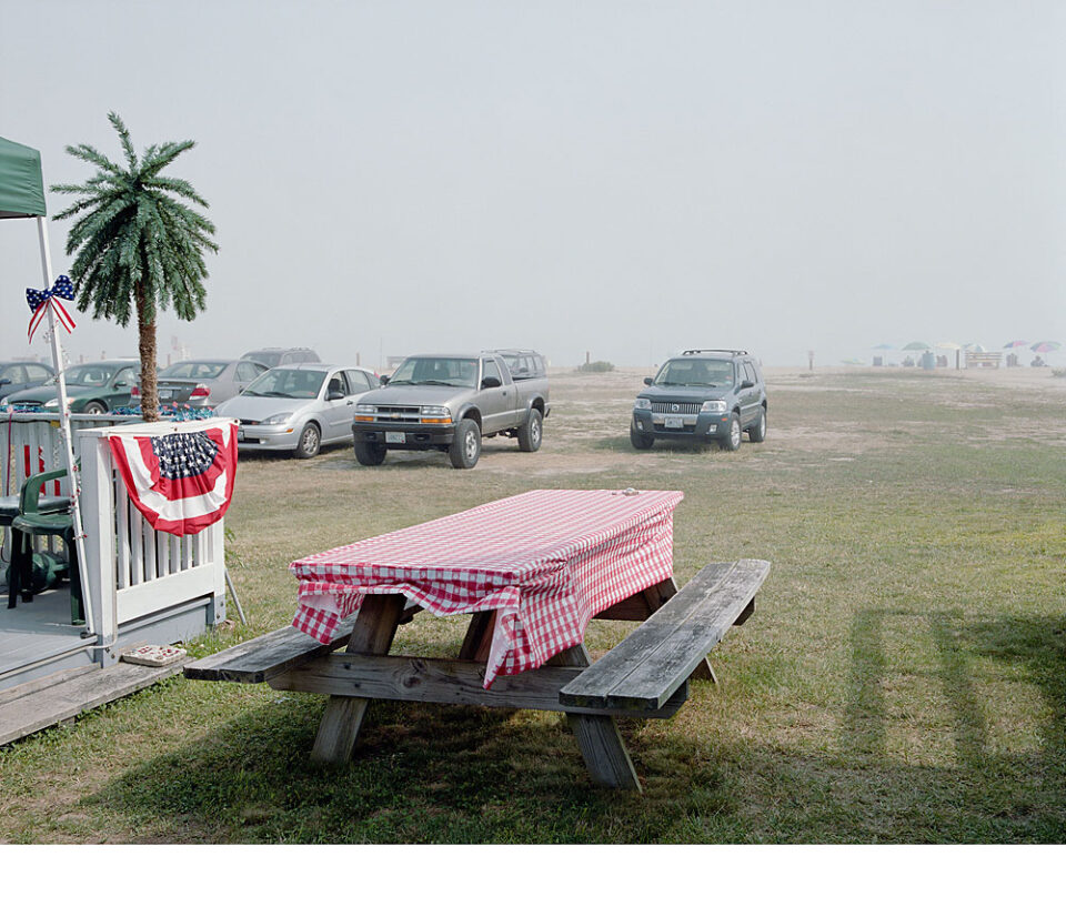
Picnic
Used to Be
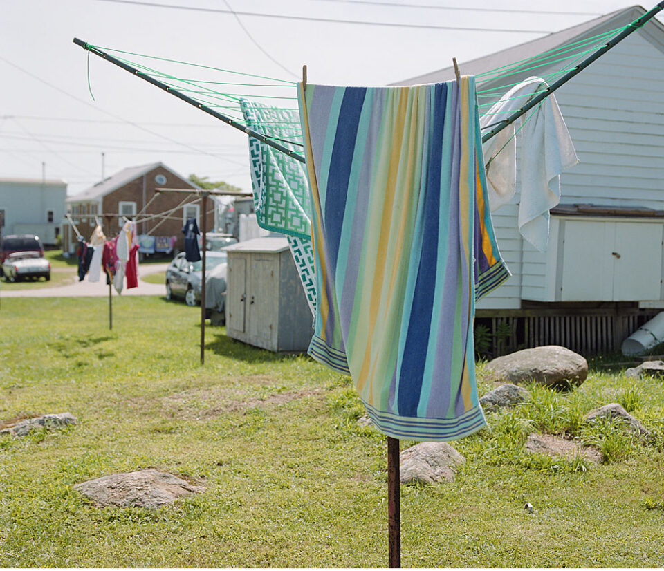
Welcoming the Breeze
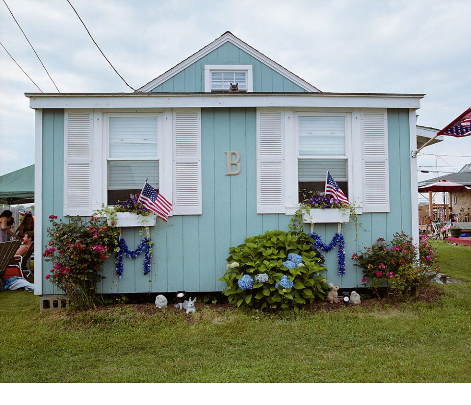
Summer Dress
RJ
Elevated
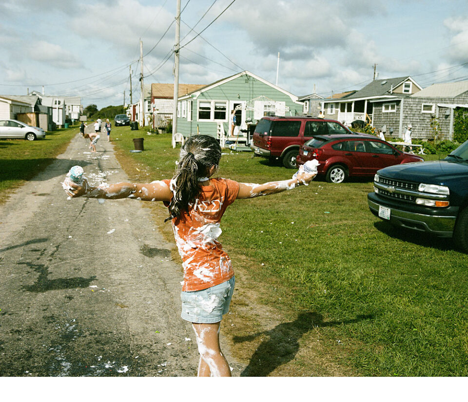
Refugee from the Shaving Crème Wars
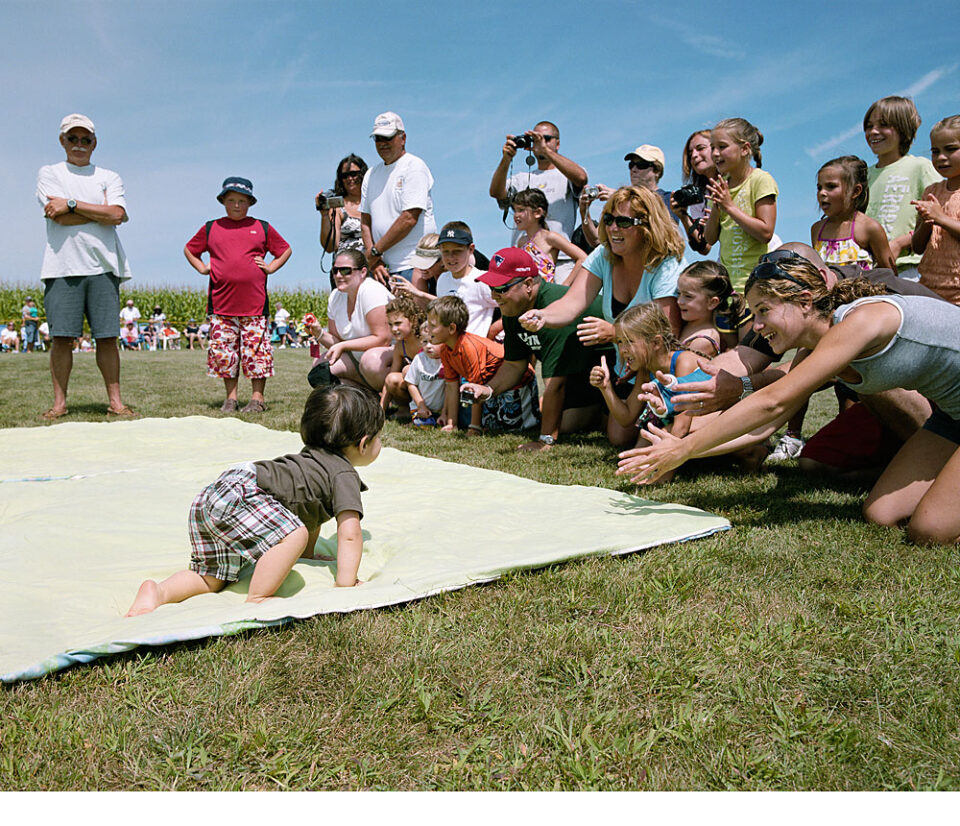
Field Day
Never Mind the Scarp
Raising the Roof
Sky Rats
I started photographing coastal land use in 2002, as a means of understanding how climate change, erosion, and coastal flooding were affecting us. In 2004, an old friend, a Rhode Islander, asked me if I had been to Roy Carpenter’s Beach in Matunuck, Rhode Island. I had never heard of the place but came to find out that it was a well-known, well-loved cottage community, adjacent to the water.
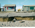
My first trip to Roy Carpenter’s Beach (RCB) was that summer, on a hot, sunny day. It was a ghost town. The cottages looked monochromatic, dull actually, and I couldn’t figure out why anyone would want to spend time there. I dismissed it as a colorless, lifeless dead end. However, in the fall of 2005, following landfall of extra-tropical storms Rita and Wilma, there were alarming media reports about the damage that had been done to this community, and the images of the destruction were impressive, frightening, and of interest. That’s when I started following the community and its coastline. I had no idea at that time that I was starting a documentary project that would be still be active in 2026 and beyond.
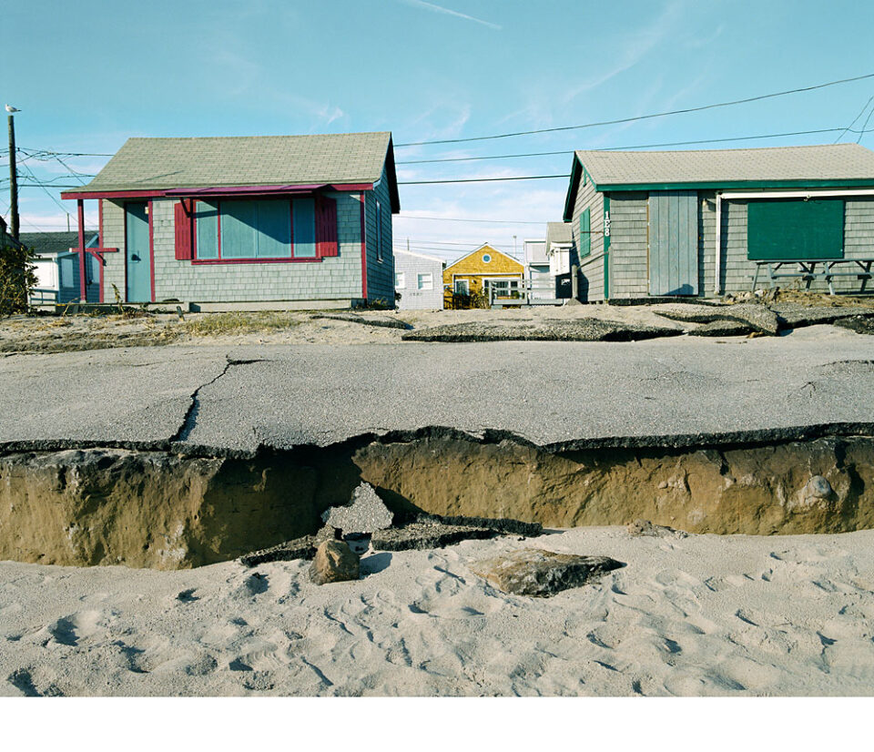
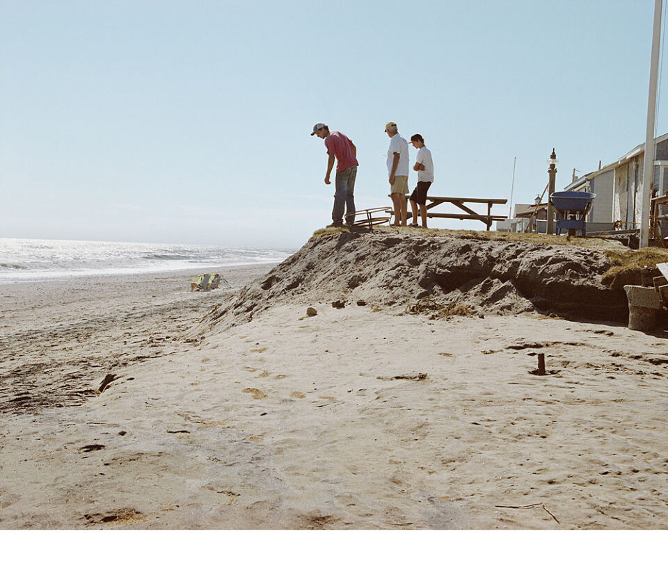
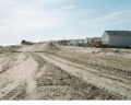
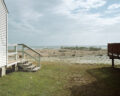
This photograph details what remained of the roadway that ran along the community’s oceanside exposure on the east side. The damage you see was the result of two post-tropical storms, Wilma and Rita, in 2005. They were the precursors that predicted the progression of erosion and storm damage at RCB in future years, as well as suggesting stop-gap measures that would be needed to hold back the inevitable. This image is my first lasting impression of Roy’s. I was also aware that this place had a microcosmic-macrocosmic relationship to what's happening along the coast, elsewhere. Or that you could extrapolate, from seeing what was happening at Roy’s, from the specific to the general, in understanding the progression of climate change in multiple locations.
That's the clinical version.... It has also become personally painful to witness this process.
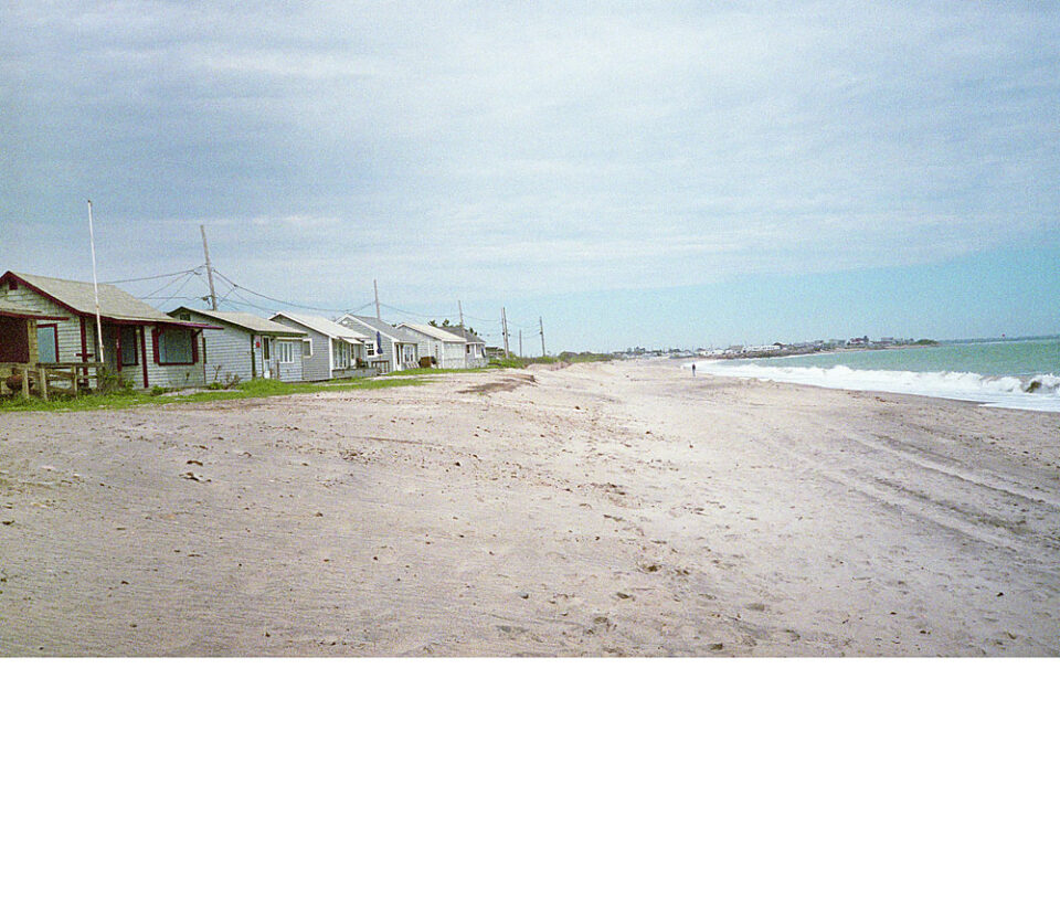
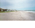
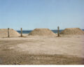
In 2008, the beach was long and wide. The roadway, that was seen in the previous photograph, was gone, and the beach at that time was nourished. (To nourish a beach means that sand is added to it… in this case, to fill in the winter’s erosion.) This beach was nourished for years, to maintain its easy slope, which made for a comfortable walk to the water. In later years, the sand was increasingly expensive and hard to find, so the beach was allowed to revert to its natural form, with steeper declines, piles of rocks, and an increasingly large scarp. (A scarp, also known as a bluff, is the result of erosion, in which water, through storms and tidal damage, eats away the shore, which retreats inland.) Over time, this coast has been retreating, as the scarp gets increasingly steep.
A graphic example of how the process of nourishing takes place and what the beach looks like during the process.
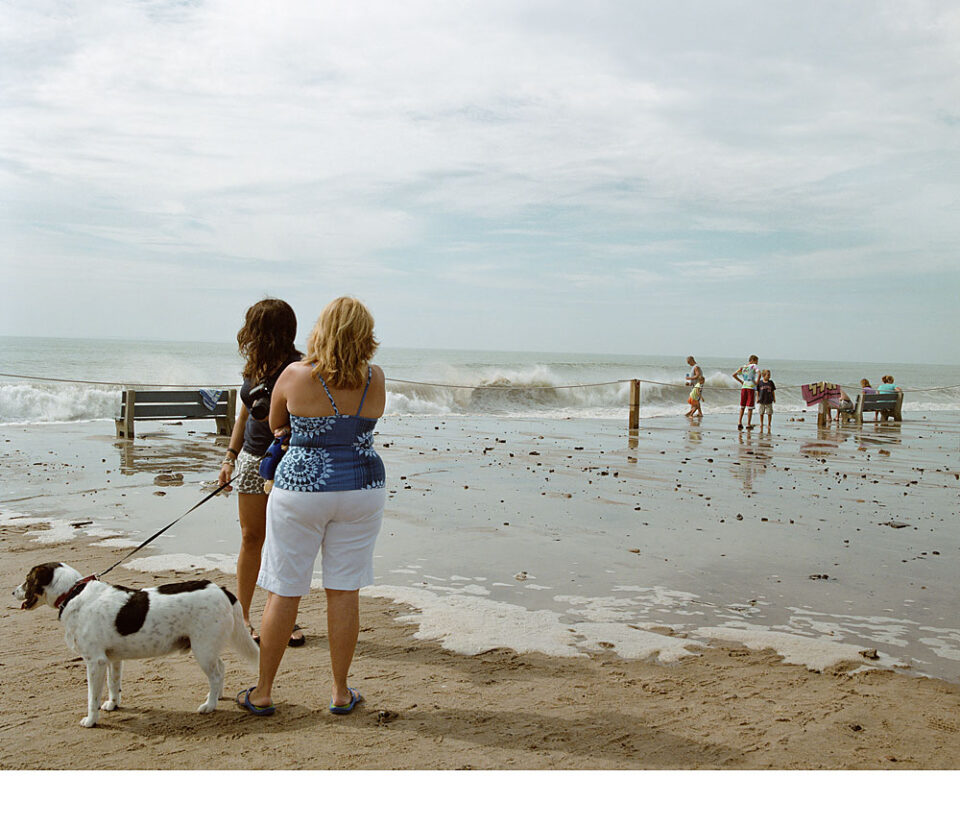
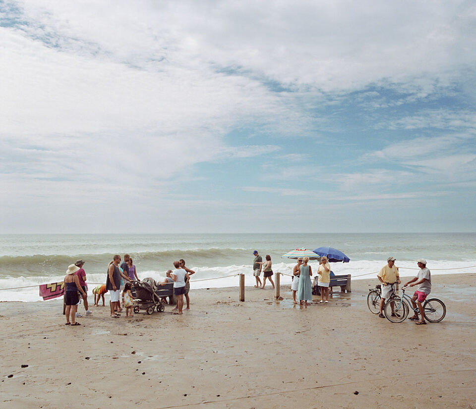
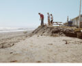
In spite of forecasts for a tropical storm in August 2009, we were spared the worst of it. The residents, however, unaware of how serious this situation might have been (or in denial, hard to say which), came down to the water to see what was happening. The community was oblivious to the potential danger that was averted. There was almost a festive atmosphere, which struck me as a painful irony.
Luckily, the worst didn’t happen... The delight and pleasantries exchanged in the wake of a would-be storm, that never materialized, would have been impossible had this storm made landfall. The ambience, and the irony, of ease and comfort are so much in conflict with the reality of the moment as to be stunning.
In 2011, Hurricane Irene came through the community and did a lot of damage – but the damage was confined to the kind that tears trim off of buildings, erodes the shore – rather than the kind of damage that rips into buildings, and tears up the shore or makes cottage owners reconsider life on a coastline.
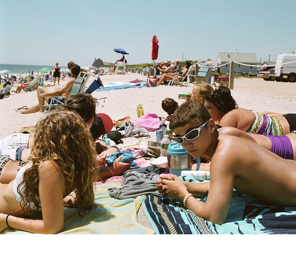
RCB is a place where all generations live and thrive, with joy.
While environmental stress is expressing itself with ever-enlarging scarps and erosion, the community nonetheless enjoys the pleasures of living on a coastline. The beach, in this image, was still being nourished.
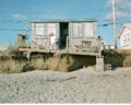
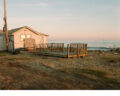
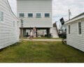
When SuperStorm Sandy came through in 2012, it tore into the cottages on the East Side of the community– three disappeared along with the land under them, and numerous others in the first two rows in that area were badly damaged. This cottage, built in the 1950s, was subsequently moved to the back row on the East Side, an area also in a flood zone.
The structures in the foreground of this photograph – further inland – were untouched by the storm, but the debris in the background of the photograph – closer to the water – reveals how far the water traveled inland.
In the first days following the storm, wires were down, debris covered a lot of the area. Various news cams from neighboring media and national crews were on scene. However, as time wore on, fewer and fewer people were on the ground. I made this photograph in December, when only the ghosts of times past were present. I was spooked and the hollow in my stomach and psyche have stayed with me since that day.
Like everybody else living in or near a coastal community, I dread the day when the so-called Big One hits us. My friend David Vallee, a meteorologist with the National Weather Service, reminds us that we haven’t seen a severe hurricane in decades. Consequently, most of us are blind to its effects and destructive power, all of which leads to our building in flood zones and taking for granted that the ocean, which we love, has a temper.
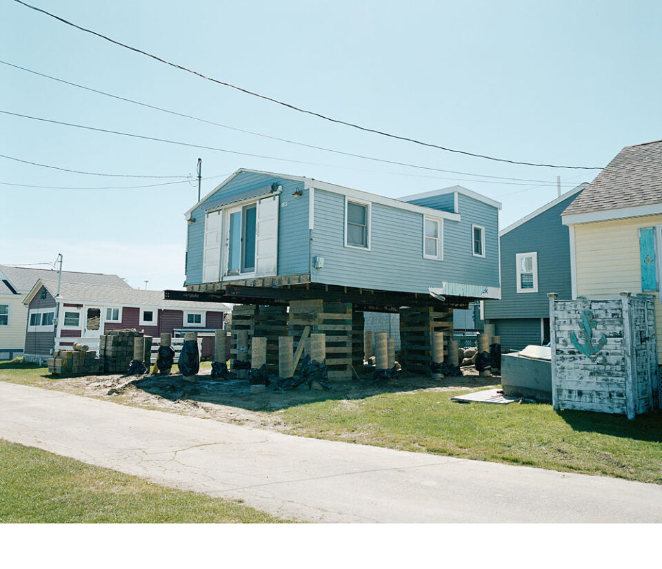
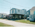
This cottage is being moved to its new location and was eventually elevated roughly 5-6 feet above ground. According to FEMA, if you change the footprint of your house or cottage by more than 50%, you are required to elevate to the Base Flood Elevation (BFE). According to FEMA:
“The elevation of surface water resulting from a flood that has a 1% chance of equaling or exceeding that level in any given year. The BFE is shown on the Flood Insurance Rate Map (FIRM) for zones AE, AH, A1–A30, AR, AR/A, AR/AE, AR/A1– A30, AR/AH, AR/AO, V1–V30 and VE.”
Following SuperStorm Sandy’s visit to Roy’s, the first two rows of the cottages closest to the water on the East Side of the community were relocated to the back of the settlement. These stairs are a vestige of the last cottage to be moved off of the waterfront in that area. That land is now vacant.
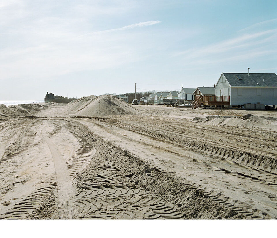
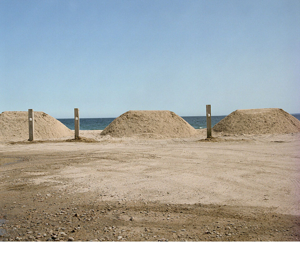
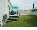
This sand is part of dune-building on the East Side of the community.
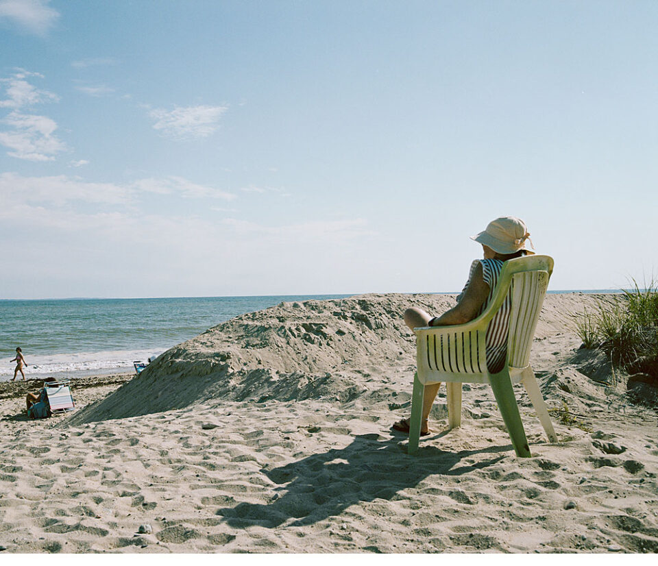
This cottage formerly had a front-row view of the waterfront. The view is now occluded by the sand that has been deposited along the shore in an effort to build up the dunes that protect the community.
Mounds of sand obstruct what was formerly a view of open water from the nearby cottages.
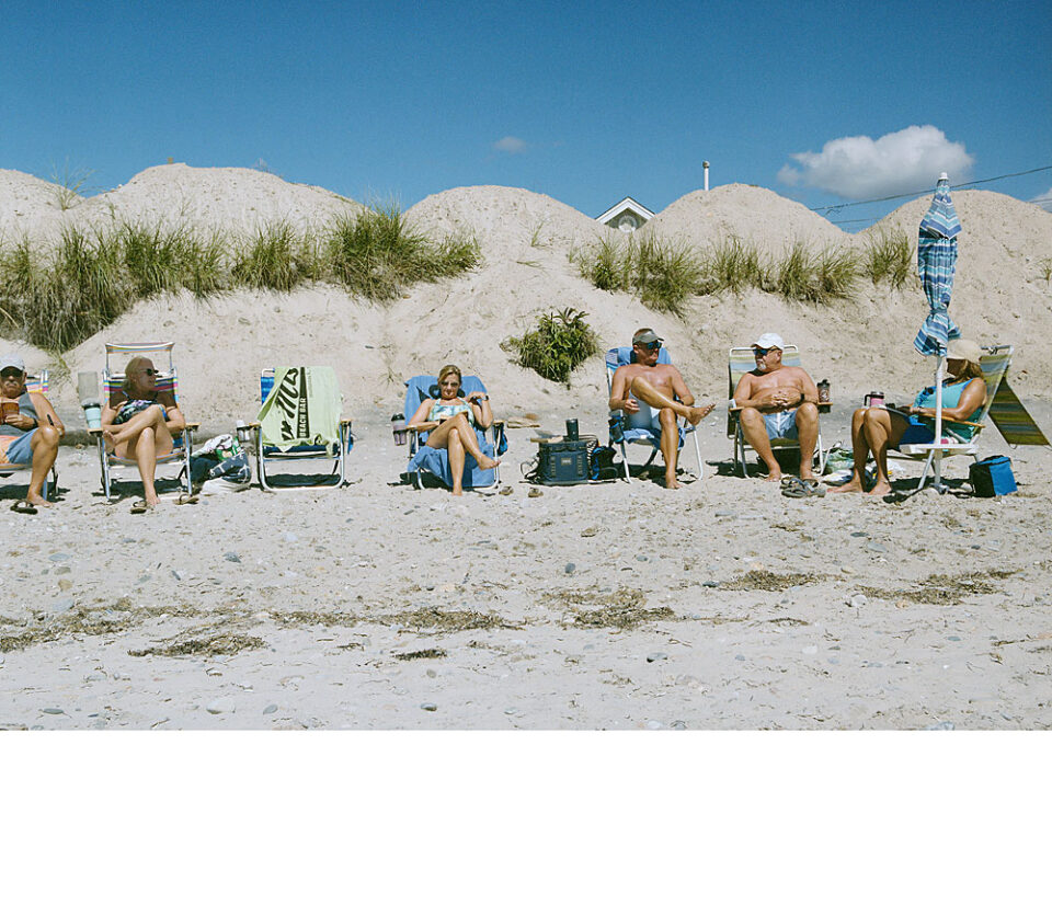
Undaunted by piles of sand that are a reminder of reality, these residents are enjoying an afternoon at the beach.
I am interested in seeing how willing the residents are to accommodate the ever-changing, diminishing beach area. The piles of sand have been adopted as part of the community, and the neighborhood. This photograph reveals the beach as it looked in 2022.
Notice the scarp, and its size, and that there now are two different levels of the beach that were once all one beach. Each level is inhabited, which speaks to the residents’ willingness to accommodate the oncoming, evolving situation.
This ramp first appeared in 2017, an acknowledgment that the beach had, indeed, changed… to the point that a ramp would be helpful - and for some, necessary - to get from one level to the other.
A bird’s-eye view of the water and the sand that was placed along the shore to protect that area.
One of many cottages displaying favorite miscellany that adorns the landscape. Residents at Roy’s have a sense of fun, welcoming the opportunity to decorate for any holiday and leaving the decorations in place for the remainder of the season.
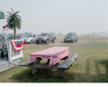
A table-in-waiting for past residents, now deceased.
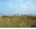
This grassy area on the East Side, allowed to revert to sea grass and native plants, was formerly occupied by cottages.
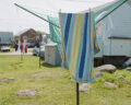
Like most places near the coast, there is a proliferation of clotheslines that take advantage of the breeze to dry the laundry.
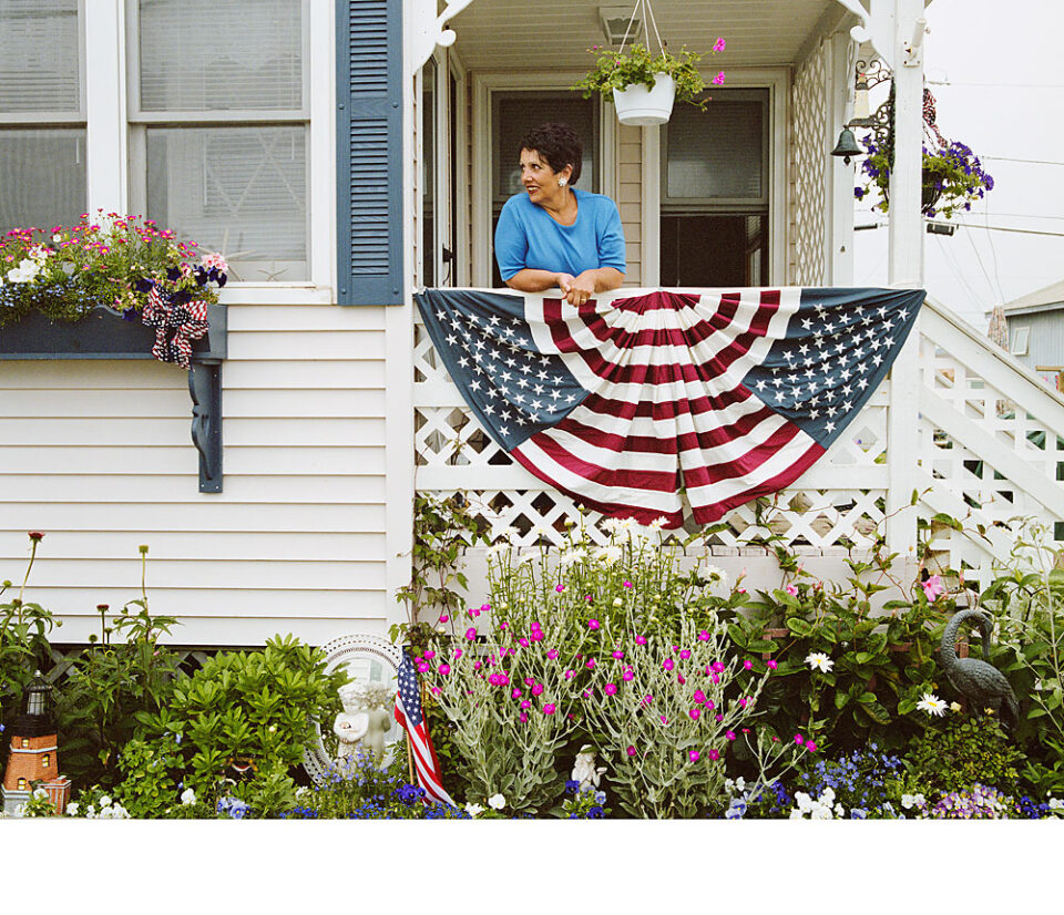
This cottage is dressed up for the Fourth of July and is typical of the way cottages meet the season – in this case, with flags and blue tasseled decorations, as roses and hydrangeas are in bloom.
One of numerous kids at Roy’s, RJ was about 8 years old when I made this portrait – he’s now a junior in college.
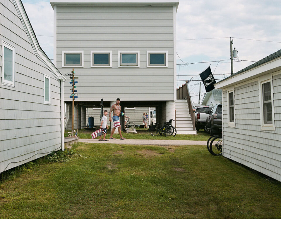
Elevated well above surrounding buildings, this cottage presumably was built to FEMA standards. While it may be safe from water, it isn’t immune from the damage other, nearby cottages will inflict on it as they slam into it during a storm surge.
Labor Day brings with it water balloons and shaving crème, all of which have been prepared the night before and hidden from opponents – the East Side against the West Side – for inevitable combat. All hell breaks loose about 6 a.m., when the kids (mostly) bombard each other with their armaments. Known as the Shaving Crème Wars, it concludes the season at Roy’s.
Ritual is a part of the summer at Roy’s. In this case it’s Field Day. The grassy field is marked out, the contestants prepare for egg races, three-legged races, etc. – and even the most junior members of the community participate.
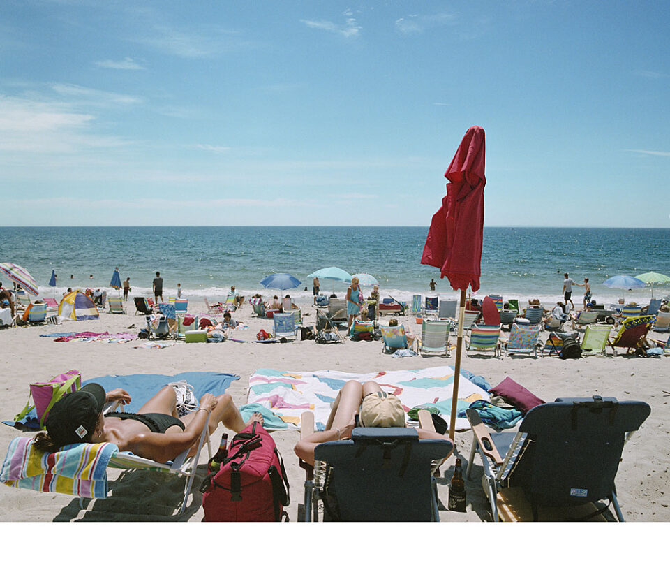
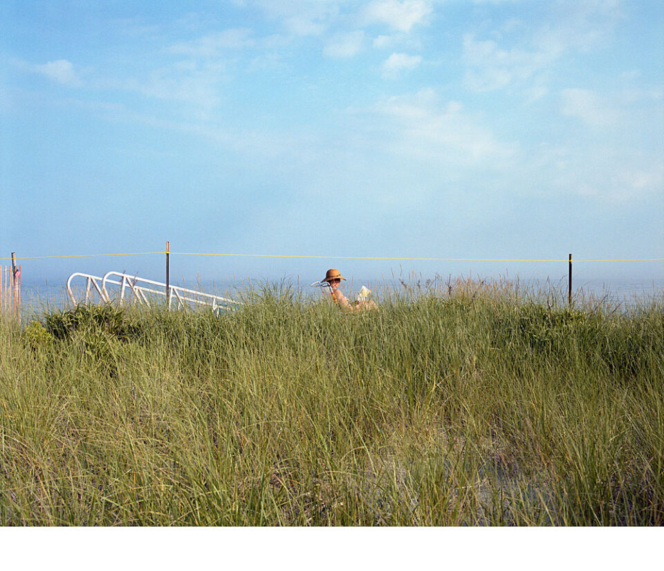
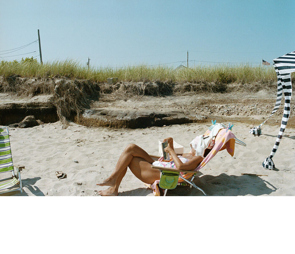
Easy-peasy in 2024, or anytime, really… just bring your beach chair, book and towel and you are ready for an afternoon on the beach. That the beach is disintegrating, just beyond your perch, is irrelevant.
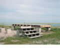
An example, in 2024, of the process of elevating a cottage. With neighboring cottages at ground level, that are likely to float, this structure is not immune to the ravages of a storm surge. The surrounding cottages are likely to slam into it.
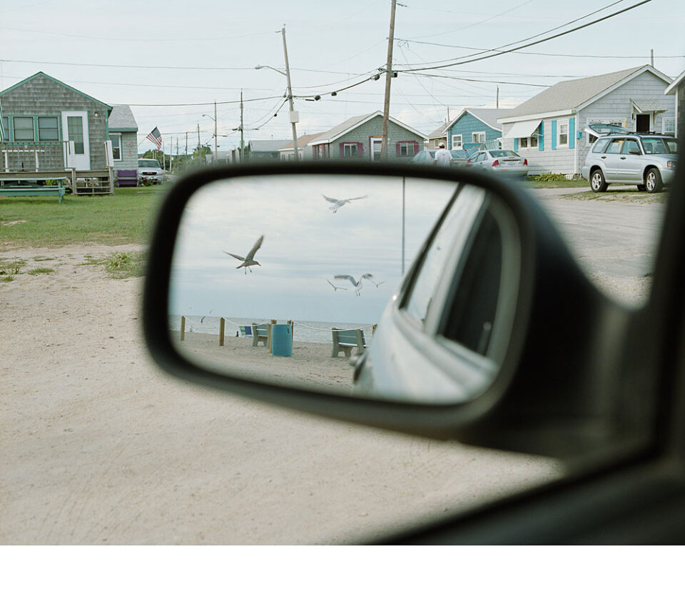
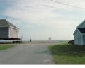
While I was repositioning my camera in my car, I happened to look out the window and saw this image. It became both a photograph and inadvertently, a time capsule. The cottages above the far-right side of the mirror, where the car sits, are no longer there, lost to SuperStorm Sandy or moved to the back of the community.